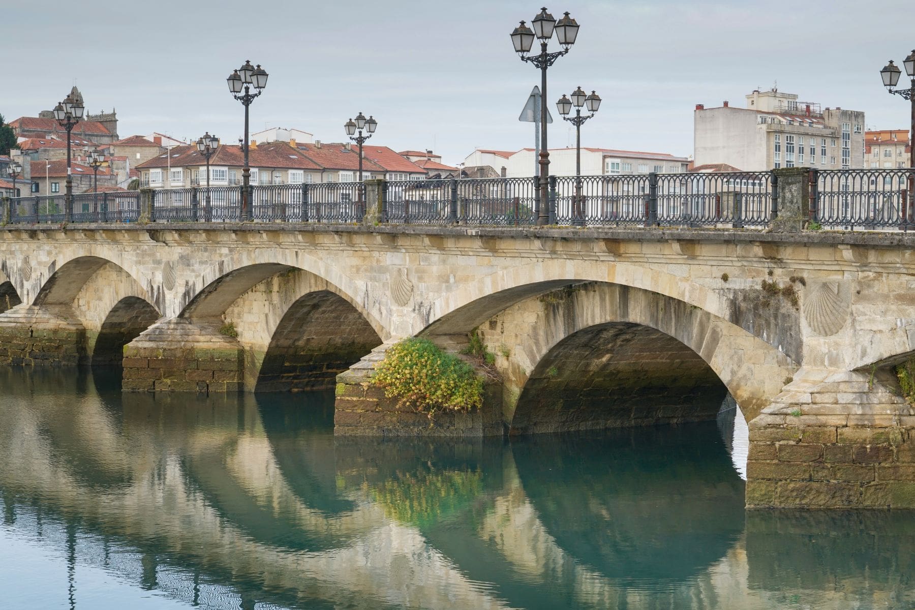
The Redondela to Pontevedra Camino is officially 18.2 km, but you may see figures closer to 20 km in apps and stage guides. That difference is not necessarily a mistake. Start and finish points, mapped tracks and the approach chosen into Pontevedra can all change the number you actually walk.
For a first-time pilgrim, the more useful planning point is that this is not simply a flat 18 km day. There are two noticeable climbs, a historic crossing at Ponte Sampaio and a choice of approach near Pontevedra that becomes more relevant after wet weather.
Key takeaways
- The official Galicia Camino website lists Redondela to Pontevedra at 18.2 km, with medium difficulty and an estimated walking time of 4 hours 35 minutes.
- Some current detailed routes measure around 19.8 km, so use the official figure as a baseline rather than assuming your door-to-door day will be exactly 18.2 km.
- Expect two meaningful climbs: one before the descent towards Arcade and another after crossing Ponte Sampaio.
- Arcade is the most practical point to plan a proper food, water or café stop before the quieter second half of the stage.
- Near Pontevedra, walkers can encounter a choice between the Tomeza approach and the natural path beside the River Gafos. The river path can become muddy and waterlogged after rain.
How far is the Camino from Redondela to Pontevedra?
The official Galicia Camino route gives a distance of 18.2 km from Redondela to Pontevedra. It classifies the stage as medium difficulty and divides it into three sections:
| Section | Official distance | Planning point |
|---|---|---|
| Redondela to Arcade | 7.1 km | First climb followed by the descent towards Arcade. |
| Arcade to Bergunde | 5.1 km | Ponte Sampaio and the main post-bridge climb. |
| Bergunde to Pontevedra | 6 km | Quieter approach followed by the final entry into the city. |
That 18.2 km figure is the best baseline for planning the official stage. However, current detailed route guides can show approximately 19.8 km.
The difference can come from how a track is measured, exactly where the route starts and ends and which streets or final approach are included. Your accommodation can add more distance again, particularly if you sleep outside the historic centre.
Practical rule: do not build the day around an exact 18.2 km finish. Treat it as the official stage distance and leave some margin for your actual accommodation, breaks and route choice.
What is the Redondela to Pontevedra route actually like?
The stage changes character several times. You leave Redondela, climb out towards the countryside, descend towards Arcade, cross the Verdugo River at Ponte Sampaio and then climb again before the longer approach to Pontevedra.
The Coastal and Central Portuguese routes use the same stage from Redondela towards Pontevedra, so this section no longer feels like the earlier coast-specific stages between Porto, A Guarda, Baiona and Vigo.
Redondela to Arcade: do not mistake the early kilometres for the whole day
The official route leaves Redondela through Cesantes and O Viso before reaching Arcade. There is a meaningful rise during this first section, followed by the descent towards Arcade and the Vigo estuary area.
This matters because the stage can look deceptively modest on paper. If you prefer a steady pace, there is little reason to push hard through the opening kilometres simply because the total distance is under 20 km.
Arcade arrives after 7.1 official kilometres and is the clearest place to plan a proper break. It has a much stronger concentration of everyday services than the quieter section that follows.
Ponte Sampaio is the obvious landmark, not the end of the hard work
After Arcade, the Camino crosses the historic stone bridge at Ponte Sampaio over the River Verdugo. The bridge is one of the most recognisable points on the stage and marks your entry into the municipality of Pontevedra about halfway across.
The important planning detail comes immediately afterwards.
The route continues through Ponte Sampaio and climbs along the Brea Vella da Canicouva. The official Galicia route describes this section as old stone paths that include parts associated with the Roman Via XIX.
If your legs already feel tired at Ponte Sampaio, do not assume that the remainder is simply a flat walk into the city. This second climb is one of the stage features worth knowing about before you start.
The final kilometres are quieter before Pontevedra
After the climb, the official route approaches Pontevedra through places including A Boullosa, Santa Comba de Bértola, Santa Marta, Tomeza, Casal do Río and O Marco.
This is why Arcade works well as a planned resupply point. Do not assume that the rest of the stage will provide the same concentration of cafés, shops or other services.
You do not need to carry excessive supplies for an 18 to 20 km day, but leaving Arcade without enough water or a small snack creates an avoidable dependency on whatever happens to be open later.
Where should you stop between Redondela and Pontevedra?
For most first-time pilgrims, Arcade is the easiest place to build a deliberate stop into the day.
It comes early enough that you should not need a long rest immediately, but late enough to work well for coffee, food, water or a short reset before Ponte Sampaio and the second climb.
A simple stage rhythm could look like this:
- Leave Redondela at a comfortable pace.
- Complete the first climb without treating it as a race to Arcade.
- Use Arcade to check water, food and how your legs feel.
- Cross Ponte Sampaio knowing that another climb follows.
- Take the final route decision into Pontevedra based on conditions rather than habit.
Ponte Sampaio itself is also a natural place to pause because of the bridge and riverside setting. However, do not make your food or water plan depend on one specific business being open.
Which route should you take into Pontevedra?
The last part of this stage includes a useful choice that many basic stage summaries overlook.
According to Pontevedra's official tourism information, waymarkers approaching the city can direct pilgrims towards two alternatives: the Tomeza route or the natural path beside the River Gafos.
The River Gafos option gives you a more natural final approach, but the local tourism office specifically warns that the path can accumulate mud and water during rainy periods. Tree roots also make it unsuitable for wheelchairs and a poor choice for bicycles.
For walkers, the decision is therefore less about finding a universally better route and more about the conditions that day.
| Approach | Useful if | Main caution |
|---|---|---|
| Tomeza route | You want the more straightforward approach into Pontevedra. | It may feel less natural than the riverside option. |
| River Gafos path | Conditions are dry and you prefer a greener final approach. | Mud and standing water can make it less attractive after rain. |
Practical rule: make this choice when you reach it. You do not need to commit to the River Gafos path days in advance.
What do first-time pilgrims commonly underestimate on this stage?
The official distance is not your complete walking total
Your accommodation may not sit exactly on the official start or finish point. A route app may also trace a slightly different line from the official measurement.
A difference of a kilometre or two is not important by itself, but it can feel important when you expected the day to finish at an exact number.
The climbs matter more than the total distance suggests
An 18.2 km stage may look easier than several of the longer days before it, but distance alone does not describe the effort. The two climbs break the day into distinct sections.
If you are deciding whether this stage fits comfortably into your wider itinerary, compare it with your previous day rather than judging it in isolation. Our Vigo to Redondela Camino stage guide covers the approach into Redondela.
Wet conditions can change the final route decision
The River Gafos approach is a good example of why a Camino plan should leave room for conditions on the day. A route that looks appealing on a map may be less useful after prolonged rain.
You do not need a second complete itinerary. You only need to recognise the decision point and choose the approach that fits the conditions when you reach it.
An official walking time is not a deadline
The official estimate of 4 hours 35 minutes describes the route, not your complete day.
Food stops, photographs, a slower climb, wet stone, route checks and the location of your accommodation can all extend the time between leaving Redondela and putting your pack down in Pontevedra.
Plan enough margin that you do not need to chase the official estimate.
Night-before checklist for Redondela
- Check where your accommodation sits relative to the Camino route out of Redondela.
- Use 18.2 km as the official baseline, but expect your actual walking total to vary.
- Carry enough water to reach Arcade comfortably.
- Decide whether Arcade will be your main food or café stop.
- Keep a small snack for the quieter section after Ponte Sampaio.
- Check the weather, particularly if recent rain may affect the River Gafos approach.
- If you use baggage transfer, reconfirm the destination accommodation rather than relying only on the town name.
- Check where you are staying in Pontevedra so the final kilometres do not surprise you.
FAQ
How many kilometres is Redondela to Pontevedra?
The official Galicia Camino route lists the stage at 18.2 km. Some current mapped guides show approximately 19.8 km because measurement methods, exact endpoints and route traces differ. Your accommodation locations can change the real walking total again.
Is Redondela to Pontevedra difficult?
The official route classifies the stage as medium difficulty. The main reason not to judge it purely by distance is the presence of two noticeable climbs, including the ascent after Ponte Sampaio.
Where is the best place to stop for food?
Arcade is the most practical planned stop because it comes about 7.1 official kilometres after Redondela and has a concentration of everyday services. Opening times can change, so avoid making the stage depend on one specific café or restaurant.
Does the Camino cross Ponte Sampaio?
Yes. The official Portuguese Way crosses the historic stone bridge at Ponte Sampaio over the River Verdugo before continuing towards A Canicouva and Pontevedra.
Should you take the River Gafos route into Pontevedra?
It can be a good option in dry conditions if you want a more natural final approach. Pontevedra’s tourism office advises against the path for walkers during rainy conditions because mud and accumulated water can make it less suitable.
What comes after Pontevedra?
The usual next stage continues north towards Caldas de Reis. Before you fix your following morning, check our Pontevedra to Caldas de Reis Camino guide and compare that day's distance with how you expect to feel after Redondela to Pontevedra.
Your next step
Before leaving Redondela, make three decisions: where you expect to stop in Arcade, how much margin you want beyond the official 18.2 km and whether recent weather may affect your final approach into Pontevedra.
Those checks are more useful than trying to predict the stage to the exact kilometre or minute. Start with the official route, keep enough flexibility for the conditions you find and treat Pontevedra as the end of a complete walking day rather than simply a number on your stage list.